


Introduction: Securing Your Digital Territory
In the 21st century, the power of a nation isn’t just measured by its borders, but by its ability to map, monitor, and master the information within those borders. This is the realm of Remote Sensing (RS)—measurement acquired at a distance—and Geospatial Intelligence (GEOINT), which is the actionable knowledge derived from RS data (such as maps, satellite images, and location-based elements).
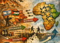
For any country, commanding this data is not a luxury; it is a fundamental act of national sovereignty. Independent control over this information is essential for everything from economic planning and navigation safety to, most critically, internal security and counter-terrorism operations. As modern strategic landscapes become increasingly ambiguous, the ability to rapidly and accurately visualise one’s own territory establishes the authoritative “model of the world” upon which all critical national decisions must be based.
The Sovereignty Trap: Why Relying on Others is a Risk
The foundational principle of national security is independent, uncompromised decision-making. Yet, relying on geospatial information provided by foreign governments or commercial entities introduces structural vulnerabilities that threaten this independence.
The Dangers of External Dependence
The global commercial remote sensing market is heavily concentrated in a few major powers and their close allies (e.g., the United States, Canada, France). For a purchasing nation, this dependence creates three key strategic risks:
- Geopolitical Bias and Denial: During a regional crisis, commercial access to critical geospatial data could be suddenly limited, restricted, or outrightly denied based on the foreign policy interests of the vendor country. This passive denial can severely impair a dependent state’s ability to respond to a crisis.
- Cartographic Censorship: This refers to the intentional blurring, omission, or degradation of sensitive data in commercial imagery, a practice historically used for military goals. This censorship, often mandated by the providing country’s laws (such as restrictions on imagery over certain allied nations), forces national intelligence analysts to operate with incomplete, skewed, or censored information, creating critical intelligence blind spots.
- Data Integrity and AI Bias: Beyond censorship, using external, non-audited sources increases the risk of deliberate data manipulation, such as the introduction of “fake data” or location spoofing into spatial databases.Furthermore, if foreign-developed Artificial Intelligence (AI) models are used for core GEOINT analysis, a country risks inadvertently importing external ethical biases into its most sensitive decision-making processes, affecting areas like collateral damage mitigation and adherence to legal frameworks.
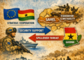
Mapping National Security: GEOINT in Action
Independent remote sensing capability provides a decisive, non-intrusive advantage across security, intelligence, and counter-terrorism (CT) operations.
Core Advantages in Intelligence and Security
- Situational Awareness: RS provides a neutral, un-altered view of events on the ground, which is vital for monitoring strategic areas and cross-border disputes without physical intrusion. This systematic collection of data is key to establishing an authoritative intelligence baseline.
- Early Warning: Proprietary sensing capability enables a state to monitor subtle, early indicators of non-conventional or “grey zone” aggression—such as rail movements consistent with military buildup—allowing policymakers to take diplomatic or pre-emptive action before a full-scale crisis erupts.
- Coordination and Response: GEOINT acts as the common organisational thread, combining all streams of data (imagery, signals, human intelligence) around its geographical location. This enables comprehensive visualisation necessary for commanders, first responders, and policy planners.
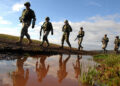
Applications in Counter-Terrorism
In CT operations, geospatial tools are essential for both prevention and response.
- Border Security: GEOINT is indispensable for managing and safeguarding borders against threats like transnational criminal organisations (TCOs) and the smuggling of weapons or foreign terrorist fighters. It allows agencies to model and anticipate where TCOs may exploit terrain vulnerabilities.
- Targeted Operations: Geospatial tools help security agencies analyse the landscape where terrorist presence is suspected, aiding in crime mapping, hot-spot identification, and protecting critical national infrastructure.
- Post-Attack Assessment: After an incident, geospatial technologies combined with airborne sensors are critical for rapidly assessing damage, establishing evacuation zones, locating evidence, and guiding rescue efforts.
Operational and Technological Constraints
Despite these advantages, remote sensing faces limitations that must be addressed:
| Constraint | Description |
| Cost & Expertise | High costs are associated with advanced infrastructure and the sophisticated technical training required to interpret and manage the data effectively. |
| Sensor Gaps | Technical constraints can lead to discrepancies in data quality (e.g., image classifications) and pose difficulties for accurate ground-truth verification in difficult-to-access conflict areas. |
| Technological Fidelity | Specialised capabilities, like infrared and hyperspectral imagery, remain harder to develop than standard visual-band imagery, potentially creating strategic data gaps. |
Affordable Independence: Practical Steps for Resilience
The capital cost of owning a satellite constellation often seems prohibitive. However, nations can achieve high-fidelity geospatial independence through a strategic investment in domestically controlled, lower-altitude platforms.
Recommendation 1: Harnessing UAS Photogrammetry
Unmanned Aircraft Systems (UAS), or drones, offer a highly scalable and cost-effective force multiplier. Drones provide low operating costs and rapid deployment capacity, making them ideal platforms for photogrammetry—the science of taking accurate measurements from photographs.
- High Resolution, Low Cost: UAS photogrammetry delivers the high-resolution imaging needed to create detailed, up-to-date maps of local areas, borders, and critical infrastructure.
- Sovereign Control: By controlling the entire data chain—from collection and processing to storage—a nation mitigates the risks of foreign data manipulation and ensures adherence to national security and privacy protocols.
Recommendation 2: Investing in LiDAR for Precision Intelligence
For detecting concealed threats that standard aerial or satellite imagery cannot see, Light Detection and Ranging (LiDAR) technology is a crucial investment. LiDAR is an active surveying method that uses pulsed lasers to generate highly accurate 3D spatial information (X, Y, Z coordinates).
- Anti-Concealment Advantage: LiDAR’s multi-return laser sensor can penetrate dense vegetation, allowing security forces to detect hidden installations, bunkers, or tactical positions that are completely imperceptible to regular optical imaging.
- Rapid Tactical Mapping: LiDAR data is rapidly processed into Digital Terrain Models (DTMs)—bare-earth models where trees and buildings are digitally removed. Military and security forces can use DTMs to plan precise actions, tactical displacements, and CT operations, effectively removing the asymmetric advantage of concealment used by insurgent groups.
By securely integrating this high-precision domestic data into a centralised National Geographical Information System (GIS), a nation builds a robust, authoritative intelligence framework that is immune to external compromise.
Conclusion: Securing the Digital Frontier
Achieving geospatial independence is not about rejecting global cooperation; it is about securing the authoritative knowledge necessary for sovereign action. By moving away from structural reliance on foreign or private interests and investing strategically in high-fidelity, domestically controlled technologies like UAS photogrammetry and LiDAR, any nation can secure its digital territory. This investment ensures that all decisions regarding intelligence, security, and counter-terrorism are predicated upon non-compromised, timely, and authoritative national information.
References
Anwar, N. H. (2018). Mapping terrorism and population patterns using GIS. http://article.sapub.org/10.5923.j.ajgis.20180701.02.html
BlackSky. (n.d.). Commercial remote sensing: The critical U.S. national security space imperative. https://blacksky.com/commercial-remote-sensing-the-critical-u-s-national-security-space-imperative/
Center for Strategic and International Studies. (n.d.). Commercial space remote sensing and its role in national security. https://www.csis.org/analysis/commercial-space-remote-sensing-and-its-role-national-security
Contemporary Issues in Air and Space Power. (n.d.). Legalities of spying from satellites and high-altitude balloons. https://ciasp.scholasticahq.com/article/91182-legalities-of-spying-from-satellites-and-high-altitude-balloons
Harvard Human Rights Journal. (2023, November). Privacy and veracity implications of the use of satellite imagery from private companies as evidence in human rights investigations. https://journals.law.harvard.edu/hrj/2023/11/privacy-and-veracity-implications-of-the-use-of-satellite-imagery-from-private-companies-as-evidence-in-human-rights-investigations/
National Academies of Sciences, Engineering, and Medicine. (n.d.). Models of the world for the National Geospatial-Intelligence Agency. https://www.nationalacademies.org/our-work/models-of-the-world-for-the-national-geospatial-intelligence-agency
National Geospatial-Intelligence Agency. (n.d.). About us. https://www.nga.mil/about/About_Us.html
National Geospatial-Intelligence Agency. (n.d.). GEOINT artificial intelligence. https://www.nga.mil/news/GEOINT_Artificial_Intelligence_.html
National Geospatial-Intelligence Agency. (n.d.). Mapping security: NGA’s geospatial intelligence edge in protecting America’s borders. https://www.nga.mil/news/Mapping_Security_NGAs_Geospatial_Intelligence_Edge.html
Polter, D. M. (n.d.). Remote sensing and state sovereignty. HeinOnline. https://heinonline.org/hol-cgi-bin/get_pdf.cgi?handle=hein.journals/jrlsl4§ion=14
Scholars Strategy Network. (n.d.). The U.S. government must protect citizens from geolocational disinformation and surveillance AI. https://scholars.org/contribution/us-government-must-protect-citizens
SkyWatch. (n.d.). Advantages and disadvantages of remote sensing: Understanding the limits of a powerful technology. https://skywatch.com/advantages-and-disadvantages-of-remote-sensing-understanding-the-limits-of-a-powerful-technology/
World Food Programme. (n.d.). WFP drones. https://www.wfp.org/wfp-drones


